
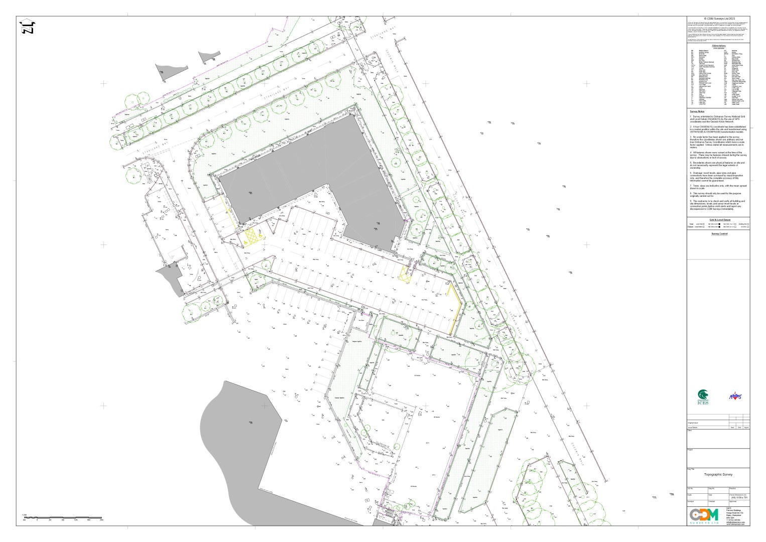
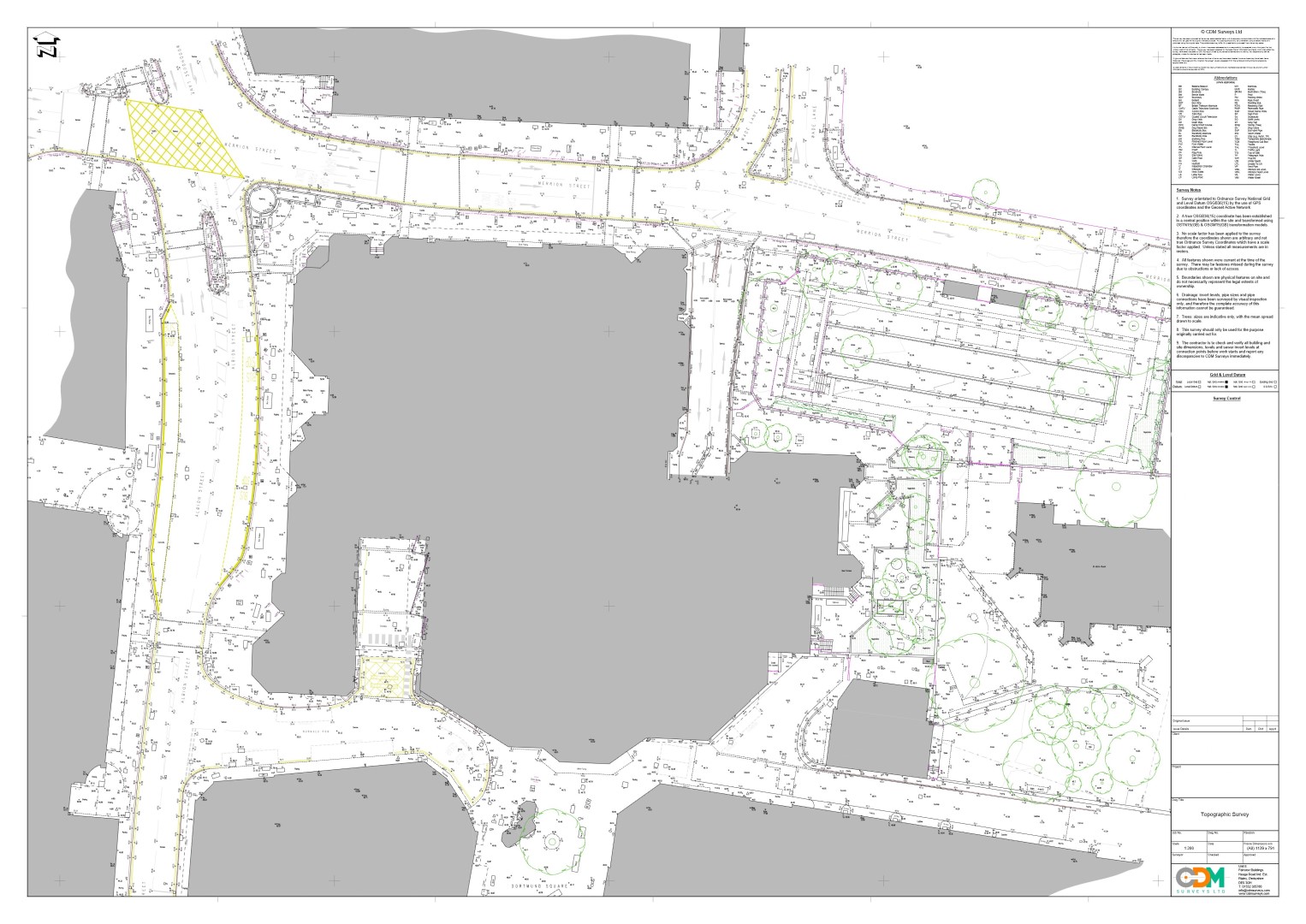
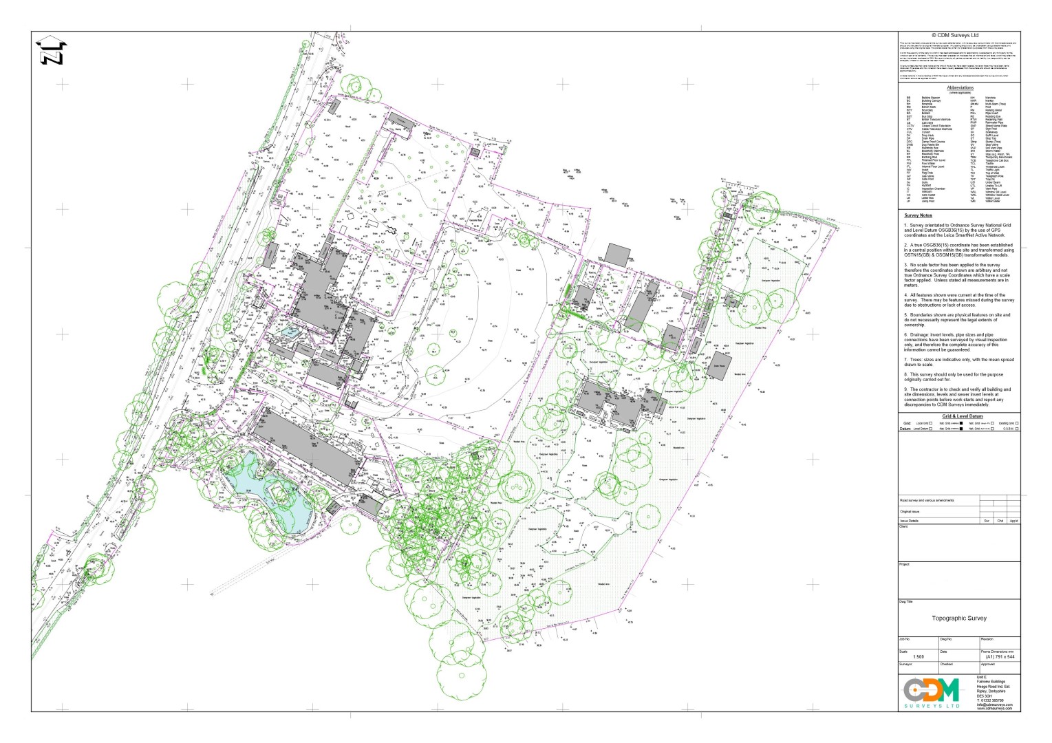
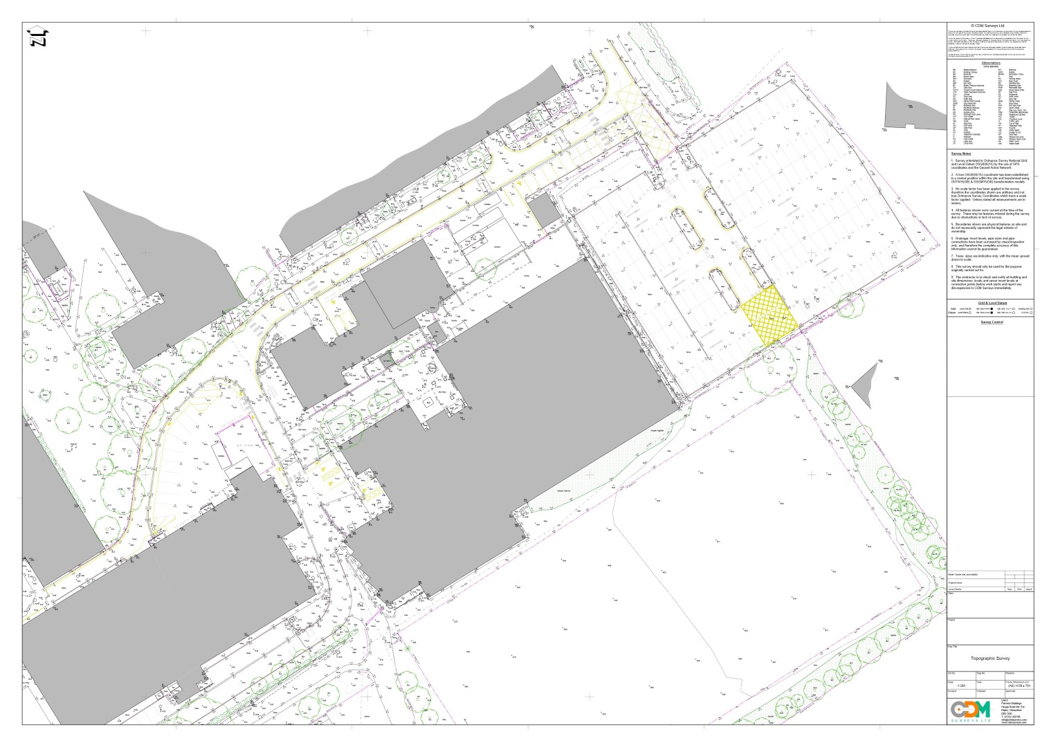
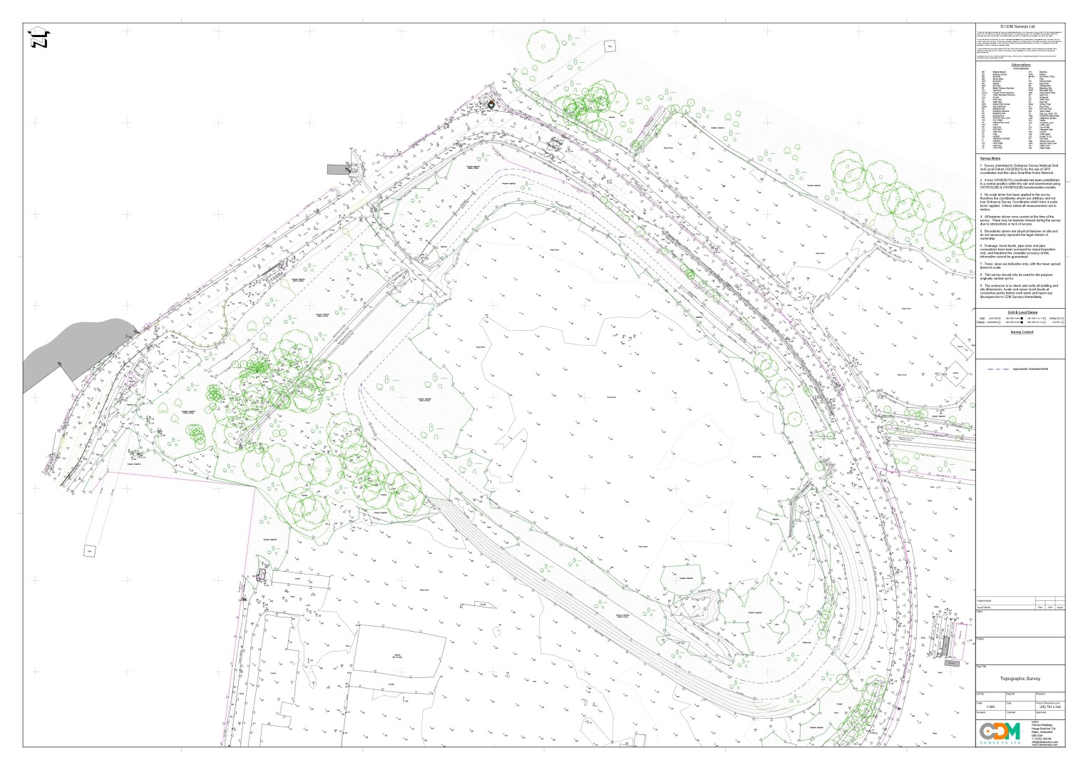
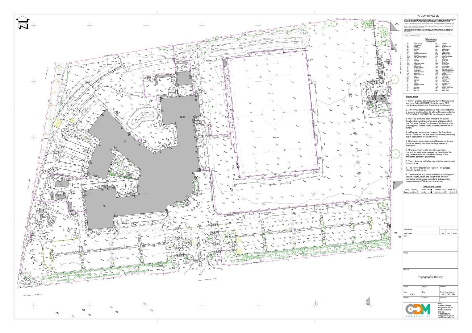
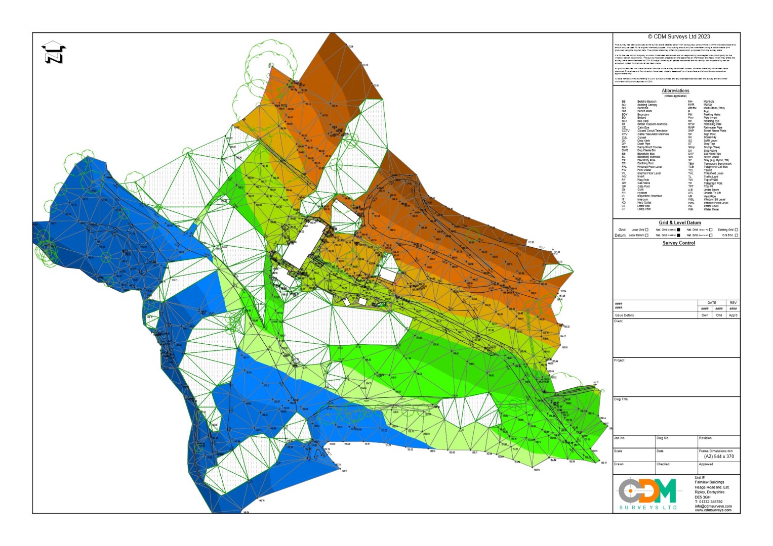
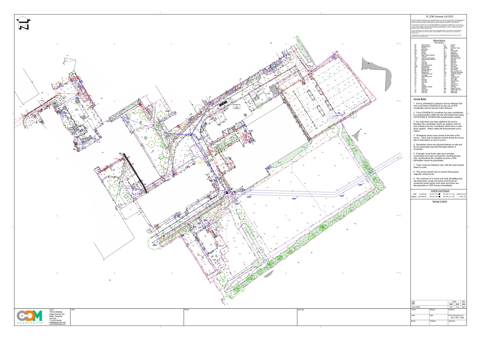
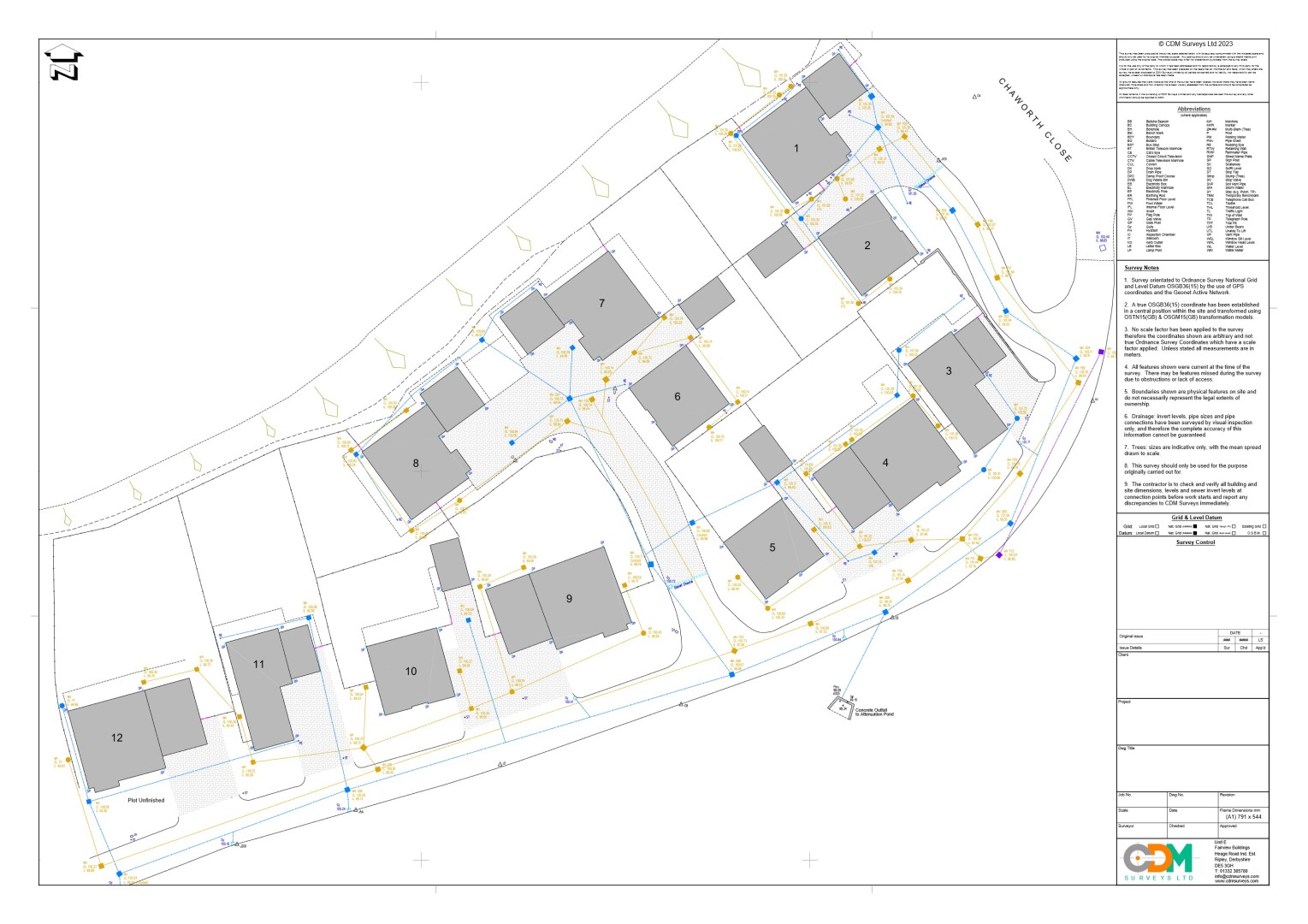
Topographical Surveys
Topographical surveys are used to establish the position and level of natural and artificial features of an area. From the information gathered from the survey, plans can be created, and presented in a format (e.g. 2D plan, contour plan, 3D terrain modelling) to suit the client and their requirements.
CDM Surveys personnel have experience in carrying out topographical surveys which stretches back more than 30 years.
As technology has moved forward, we have embraced the possibilities that these advances have brought, now using Robotic Total Stations, Global Positioning Systems (GPS) and other cutting-edge equipment, to ensure our clients benefit from the increased accuracy and efficiencies that are now possible.
Topographical surveys are carried out on a wide range of sites and areas, for a broad array of reasons; From large greenfield housing development sites, to roads, private gardens, commercial development land etc.
Typical Clients
- Architects
- Planning Consultants
- Property or Housing Developers
- Builders
- Consulting Engineers
- Landscape Designers
- Private Individual Clients
Office Space - Topographical Surveys
City Center - Topographical Surveys
Residential - Topographical Survey
Commercial - Topographical Surveys
Development Scheme - Topographical Surveys
Public Sector - Topographical Surveys
Terrain Modelling
Our topographical surveys are undertaken in 3D. This allows the results to be presented in contoured or terrain modelled formats.
The resultant survey models can then be utilised for requirements such as master planning, groundworks planning, planning applications etc.
Typical Clients
- Architects
- Planning Consultants
- Property or Housing Developers
- Builders
- Consulting Engineers
- Landscape Designers
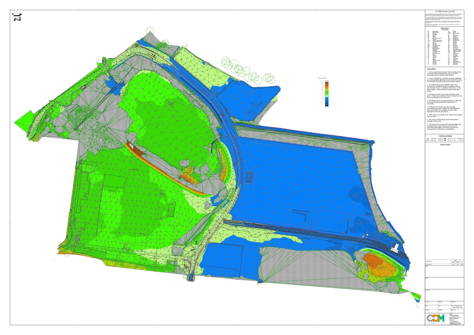
3D Terrain Modelling
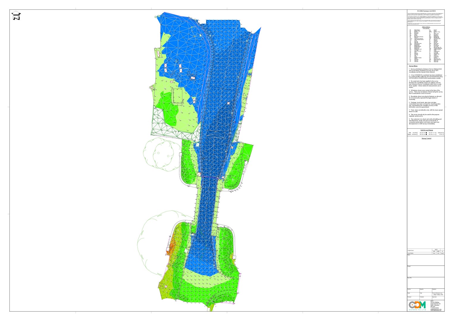
3D Terrain Modelling
3D Terrain Modelling
Volumetrics
Using measured survey data, volumes and quantities can be calculated utilising dedicated software.
Volumes are required in a range of instances, including: Stockpiles (Quarried aggregates, Soil mounds, Recycled aggregates, Coal stocks etc), Quarrying, Muckshifting, Cut & fill etc.
Whether it be for earthmoving planning purposes, costing/charging purposes, accurate volume information can be invaluable.
Typical Clients
- Quarries
- Power Stations
- Planning Consultants
- Material Recycling Companies
- Earthmoving Companies
- Consulting Engineers
- Landscape Designers
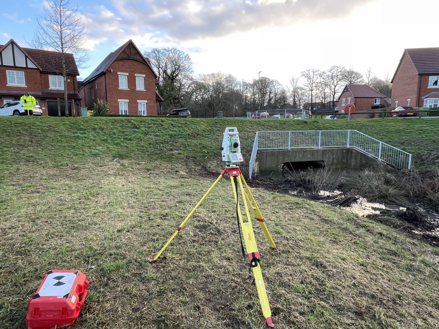
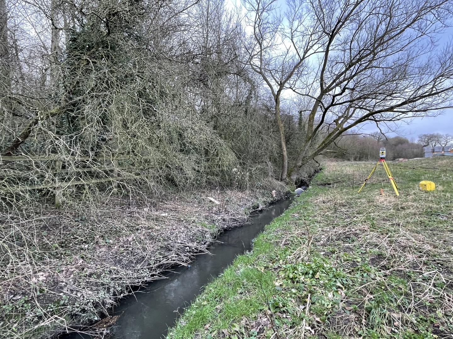
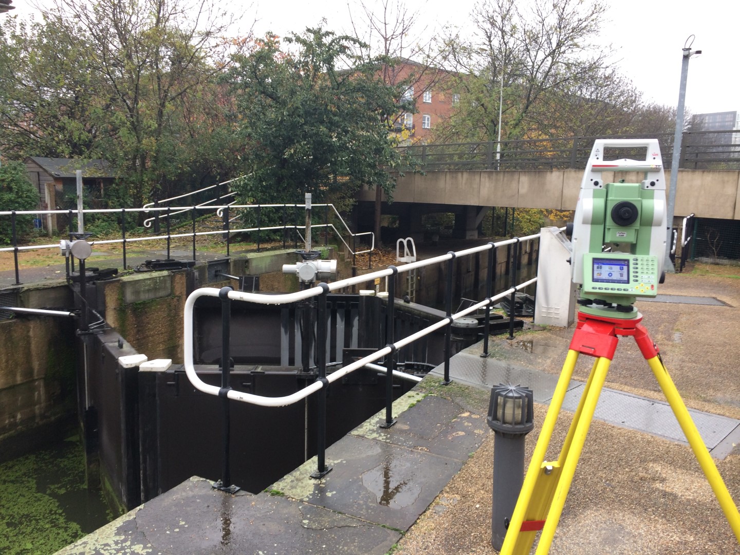
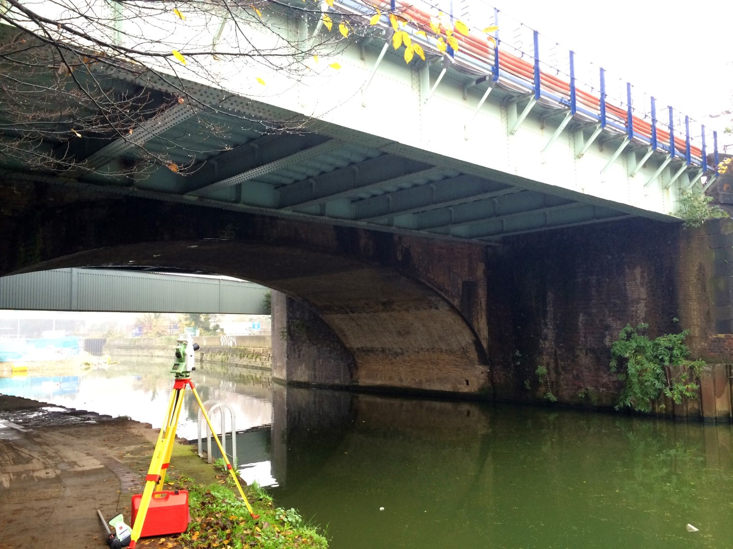
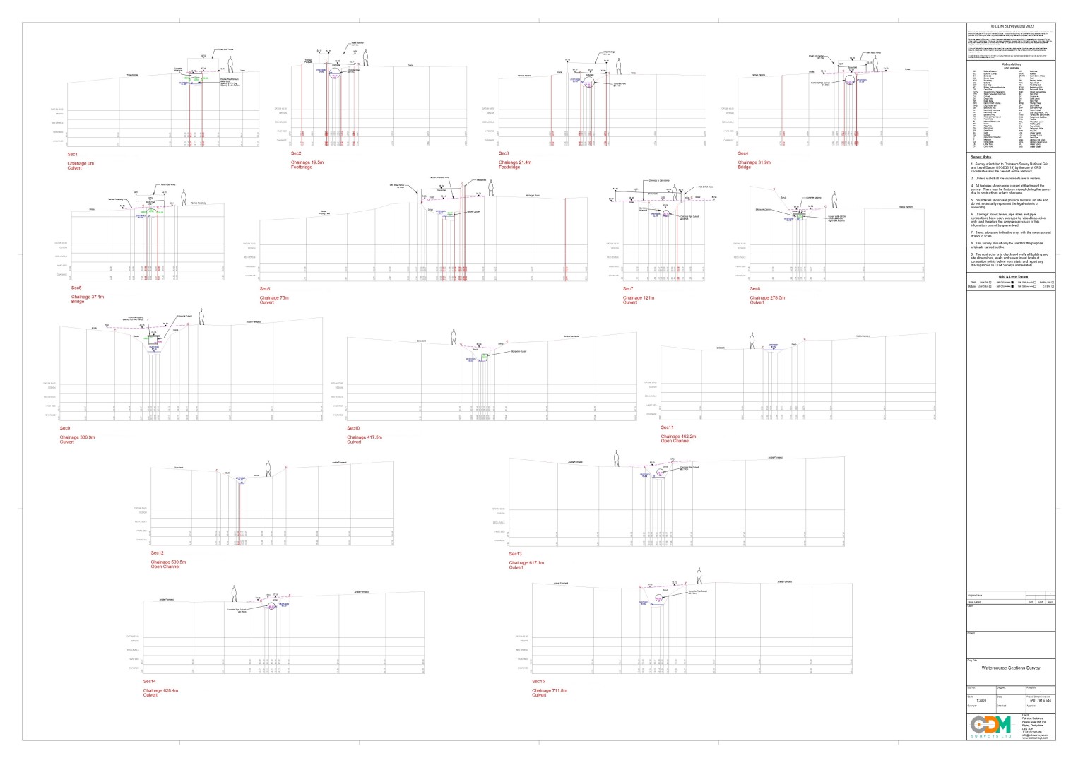
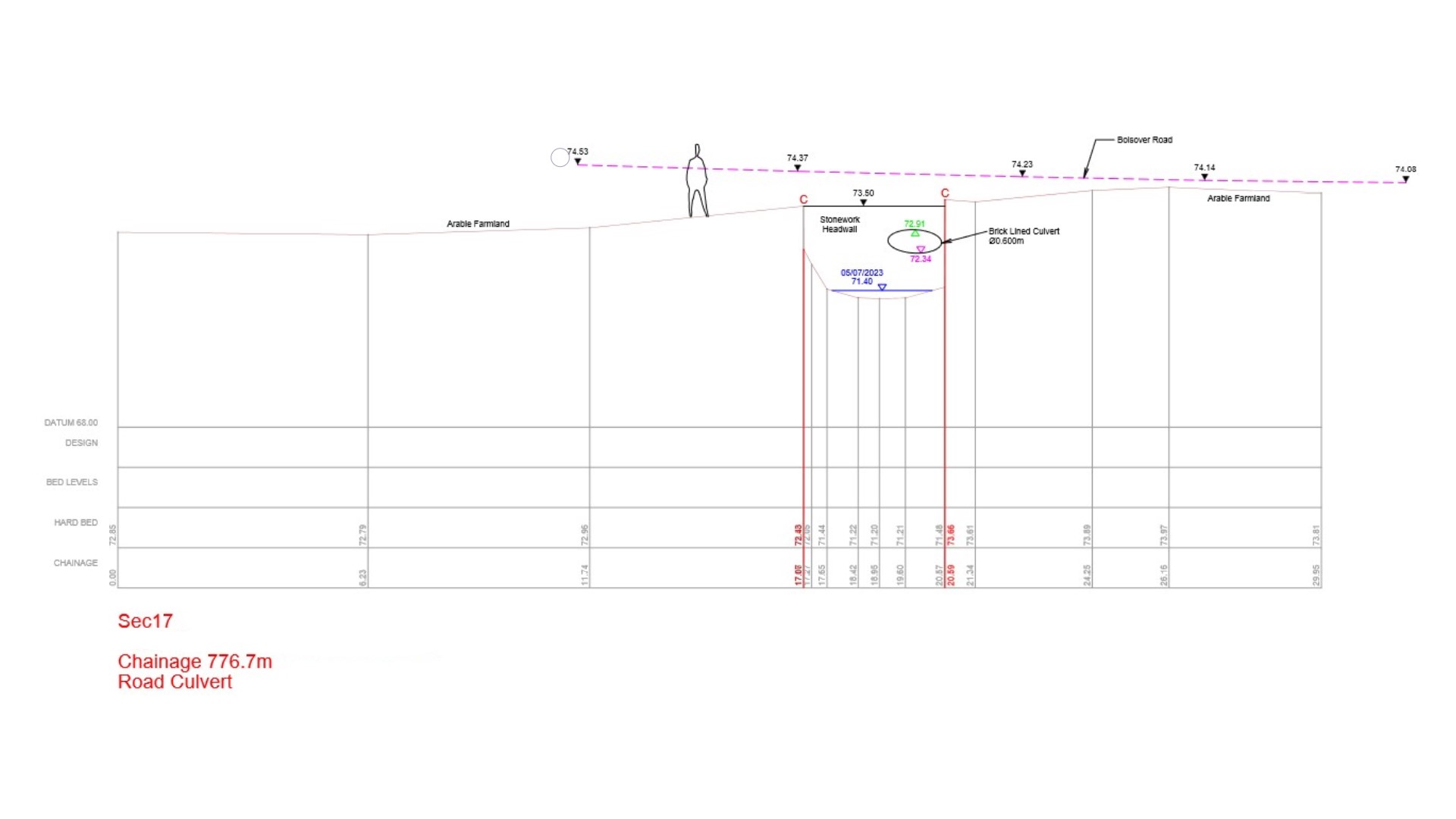
Water Courses
Water course surveying, where a series of cross sections are surveyed, to give a full picture of a specified length of watercourse is a specialist discipline. Our surveyors have surveyed and produced thousands of cross sections on a variety of rivers and other watercourses. Having river modelling knowledge and experience is invaluable during the data capture stage as when carried out correctly, it considerably improves the integrity of the final model results and ensures that all features of hydraulic significance are correctly recorded.
Once the site measurements have been completed, the gathered data is processed using specialised software to create the final model.
Typical Clients
- Property & Land Developers
- Planning Engineers & Consultants
- Consulting & Civil Engineers
- Infrastructure Engineers & Designers
Water Course Surveys
Water Course Surveys
Water Course Surveys
Water Course Surveys
Water Course Surveys
Water Course Surveys
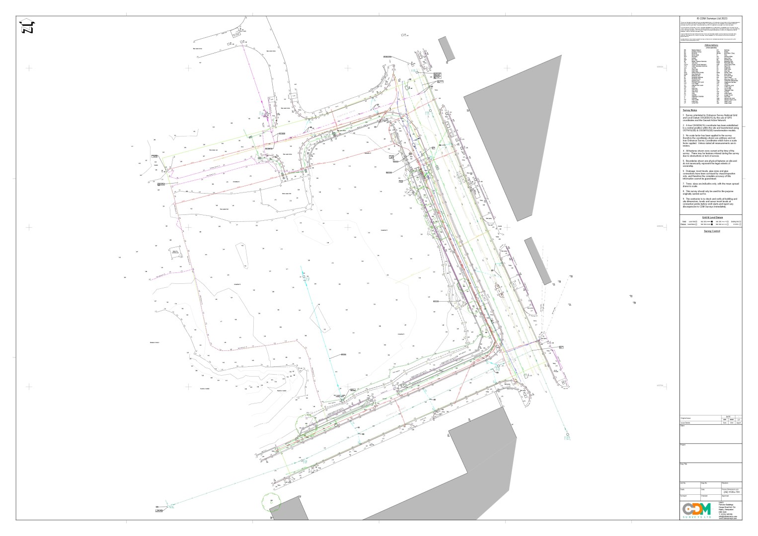
Underground Utility Mapping Surveys
For carrying out this highly specialised survey work, CDM Surveys Limited employ the services of fully trained industry experienced surveyors, the latest electromagnetic, ground probing radar equipment, remote inspection equipment and proven techniques to detect and map underground services to a high degree of accuracy across a wide range of environments; including industrial, commercial, brown field and regeneration sites, urban and city centre locations.
We understand that knowing the accurate location, nature and depths of existing buried utilities is of paramount importance to those engaged in feasibility studies, design, construction and maintenance of assets.
Like Topographical Surveys and GPS Surveys, our Underground Utility Mapping services are often required by Architects, Building Developers and Engineers who need the specific details of underground features on a specific segment of land.
Typical Clients
- Property & Land Developers
- Architects
- Building & Construction Consultants
- Planning Engineers & Consultants
- Consulting & Civil Engineers
- Infrastructure Engineers & Designers
Utility Mapping Surveys
Utility Mapping Surveys
Drainage Surveys
CCTV Drainage Surveys
CCTV survey technology is the most cost effective and most efficient way to inspect sewers and drains. CCTV surveys are used when a drainage problem has been identified, or the client would like to inspect the drain to avoid any drainage problems in the future. The survey is a precise way to get an instant, accurate look at the current condition of underground drains.
To complete a CCTV drainage survey, we use a specialised remote-controlled camera system alongside a software that is specifically designed to survey for CCTV drains surveys. The images that the cameras relay allow our surveyors to assess the condition of the drains or sewer without disrupting the surrounding properties or environments.