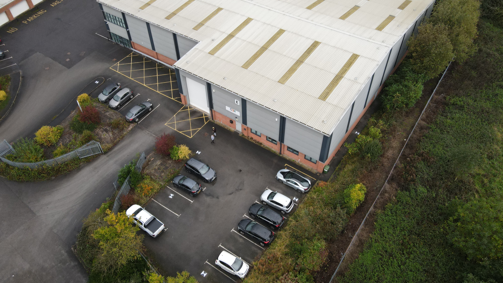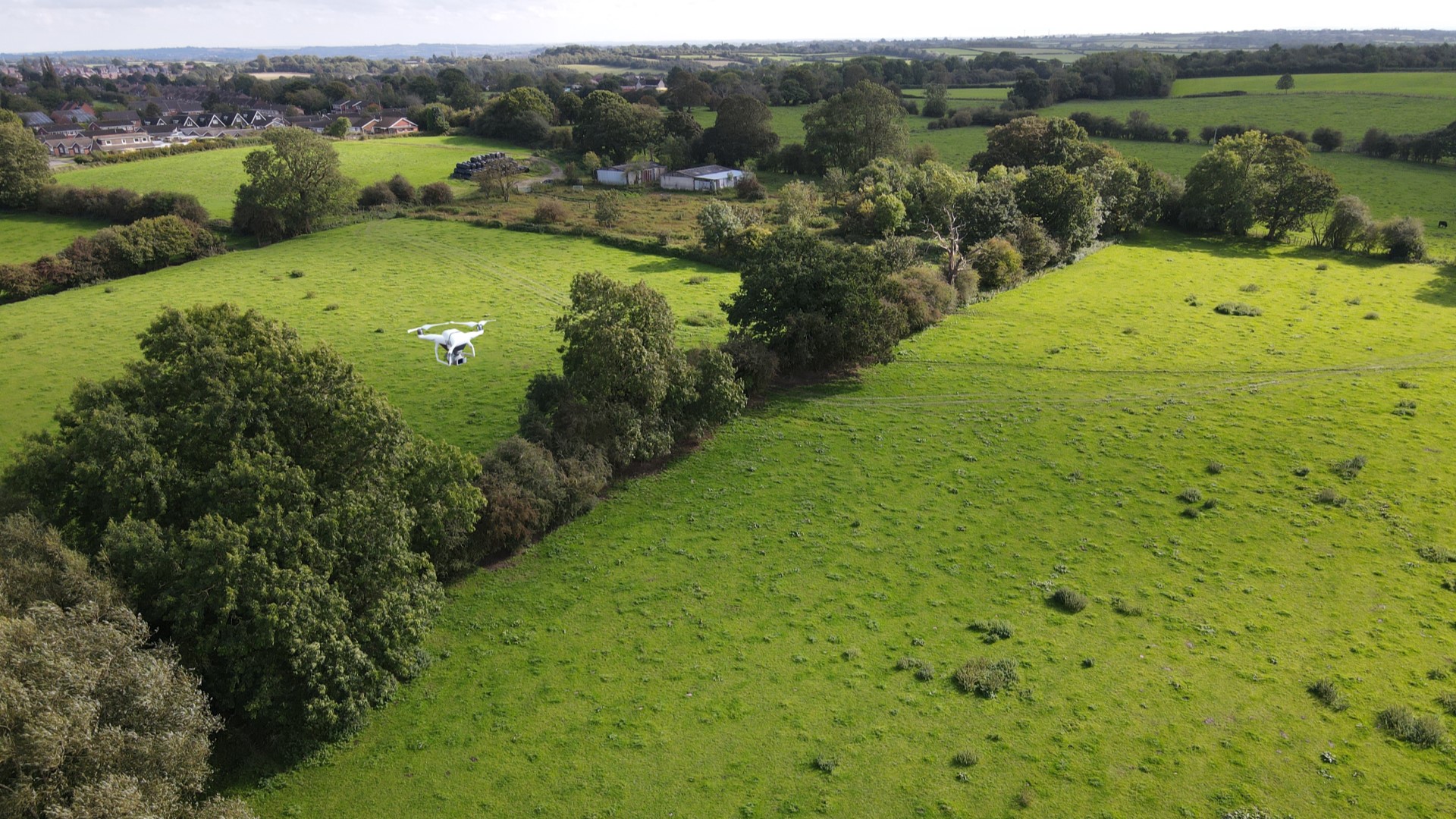
Drone Survey
Using the latest drone technology, CDM Surveys Limited can provide a wide range of drone inspections and surveys safely by capturing high-resolution imagery and survey-grade data to a sub-50mm accuracy – all in a fraction of the time taken by traditional survey methods.
CDM Surveys Limited employ trained pilots with the ability to rapidly cover large areas and access otherwise hard-to-reach locations by photographing them from the air, from several different angles and tagging the images with coordinates. From this data, photogrammetry software can create geo-referenced orthomosaics, elevation models or 3D models of the project area.
Our enhanced UAV data can be seamlessly integrated into any projects lifecycle, with services ranging from condition surveys, building elevations and topographical surveys to 3D drone mapping and Building Information Modelling (BIM).
Typical Clients
- Land Surveying
- Building Surveying
- Urban Planning
- Mine & Quarry Monitoring
- Volume Measurements
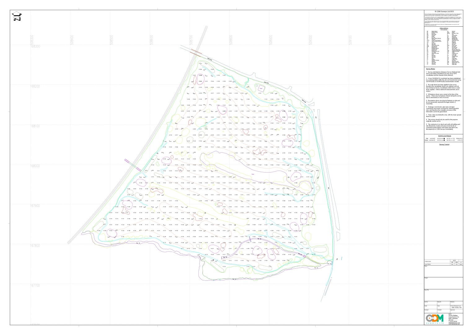
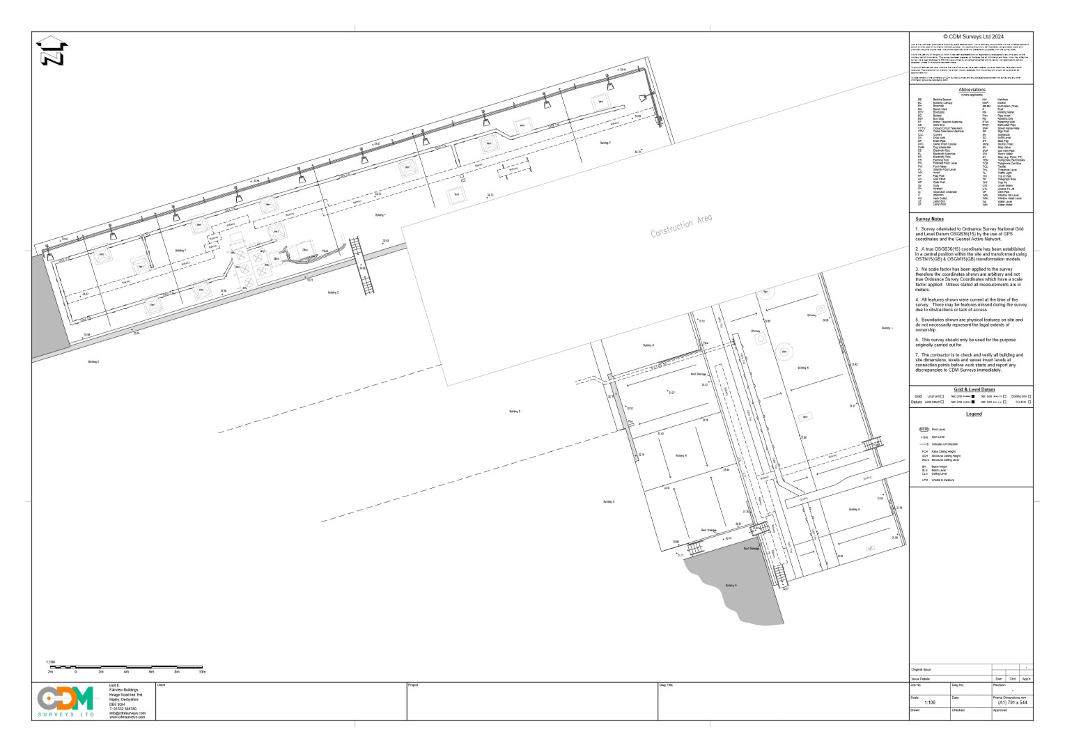
Topographical Drone Survey
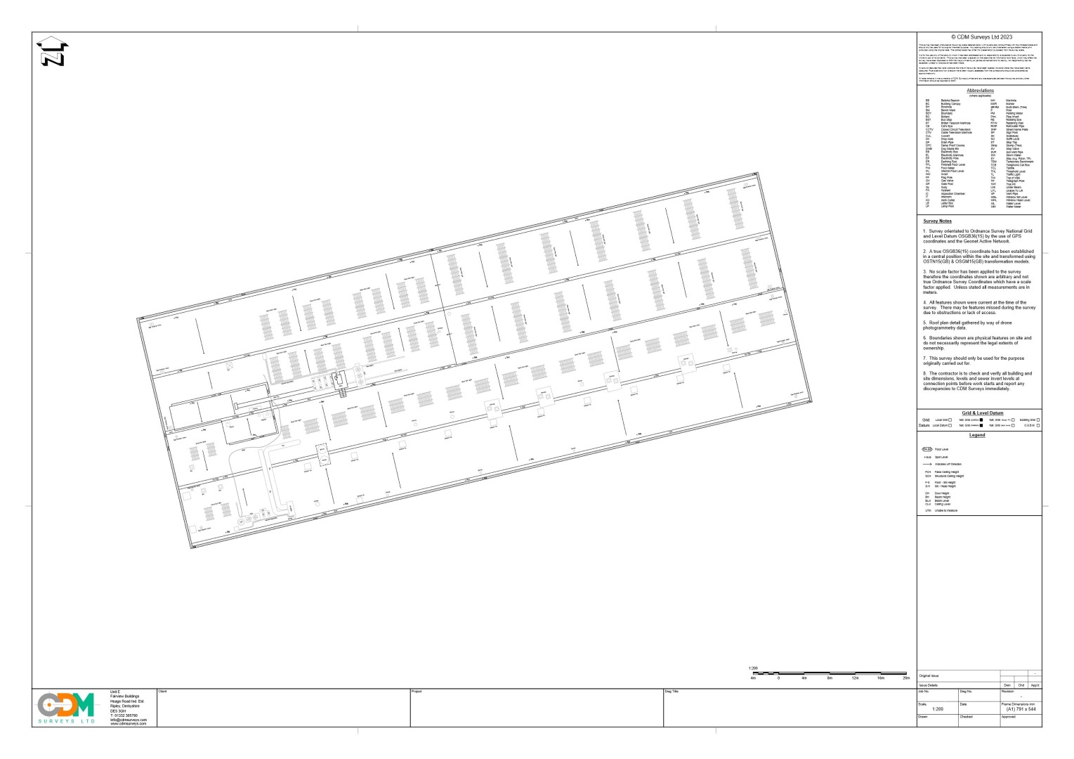
Roof Plan Drone Surveys Orientated to Nat. Grid
Roof Plan Drone Surveys
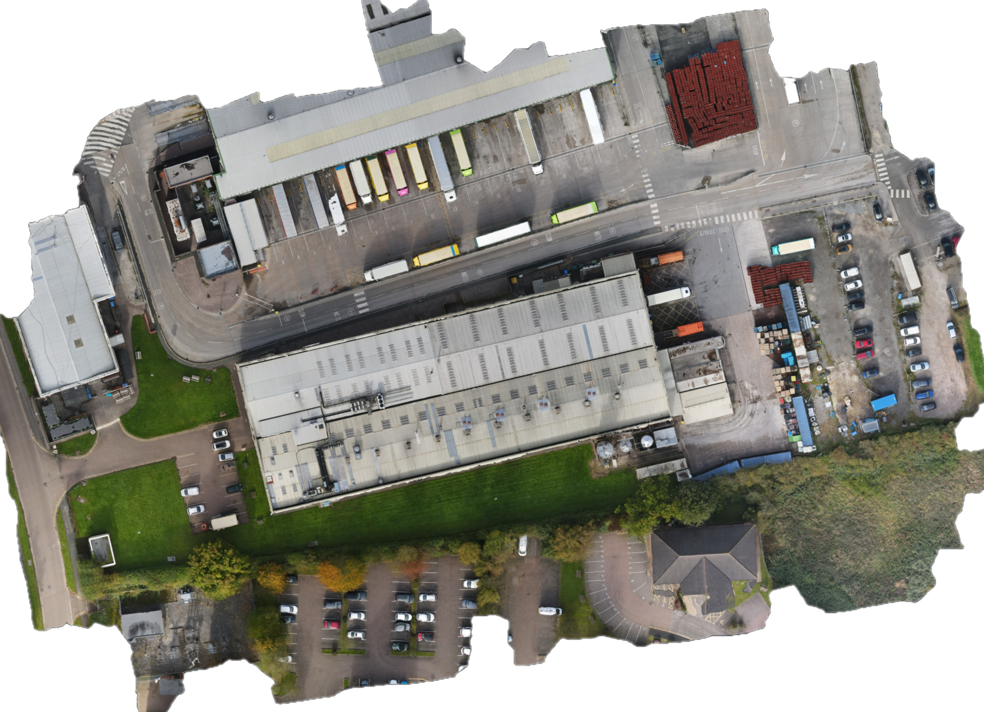
Drone Orthomosaic High Resolution Images
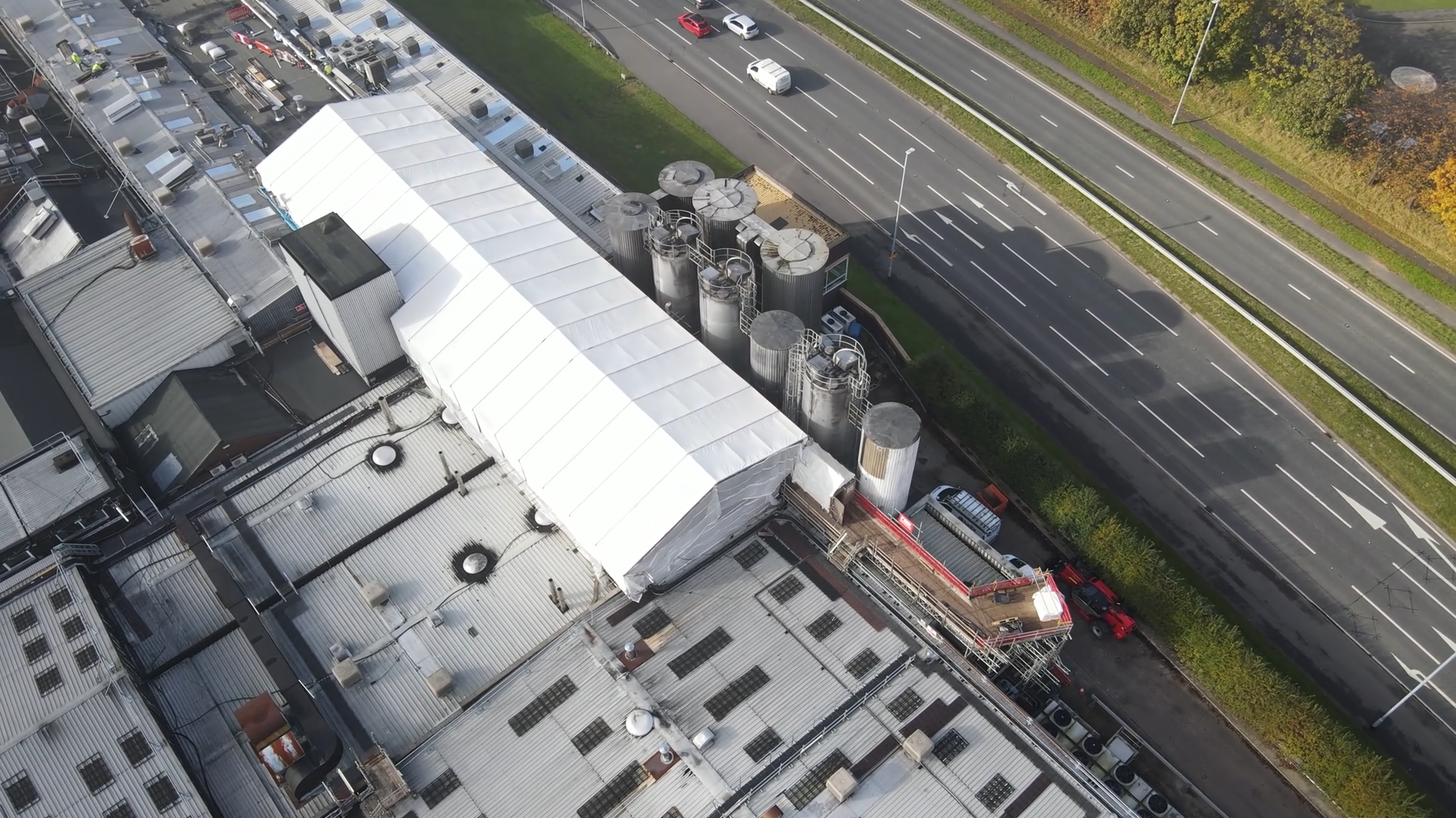
High Res Drone Videography